Directions to the Lakefield Trail
- Cycling from the Rotary Greenway Trail, Peterborough, Ontario - North from Trent University's Environmental Science Parking Lot along the Scenic River Road Trail, spanning the distance from Trent University to Lakefield.
- Driving From Peterborough, Ontario - North on Water Street past Trent University along the Lakefield Highway (County Road 29), approximately 16 km.
- Driving From Bridgenorth, Ontario - East on 8th Line of Selwyn Township to County Road 29, approximately 10 km. Turn left at County Road 29 and follow the signs to the Lakefield Trail.
Parking
Free parking is available at the:
- Lakefield Beach,
- Lakefield Arena,
- Municipal Parking lot beside the Village Inn, and
- along Water Street
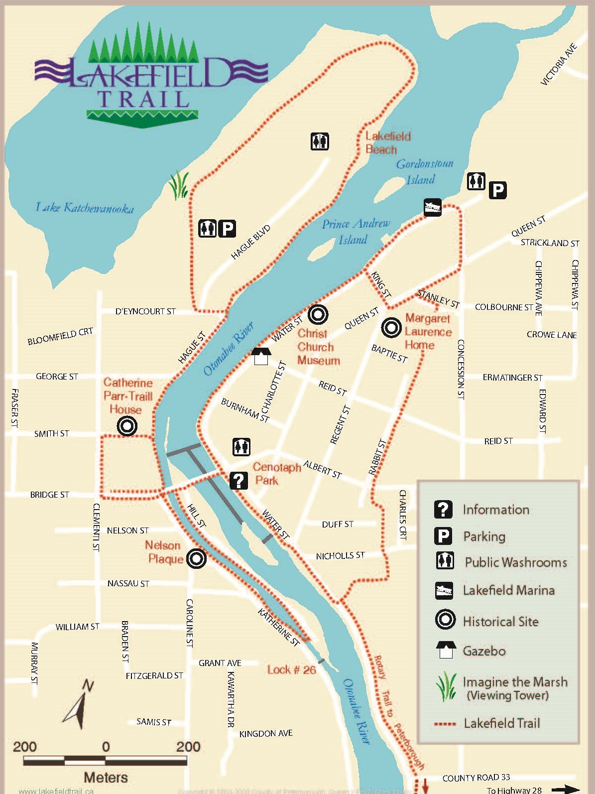
Interactive Map
As you walk along the trail, you will notice many plaques alongside trees and benches, as well as interpretive signs that provide you with a glimpse of the history of Lakefield. Using this Interactive Map you can see the location of each Memorial Bench and Tree or interpretive sign along the Lakefield Trail.
![]() Contact Us
Contact Us


